ArcGIS GeoService
Dataset description:
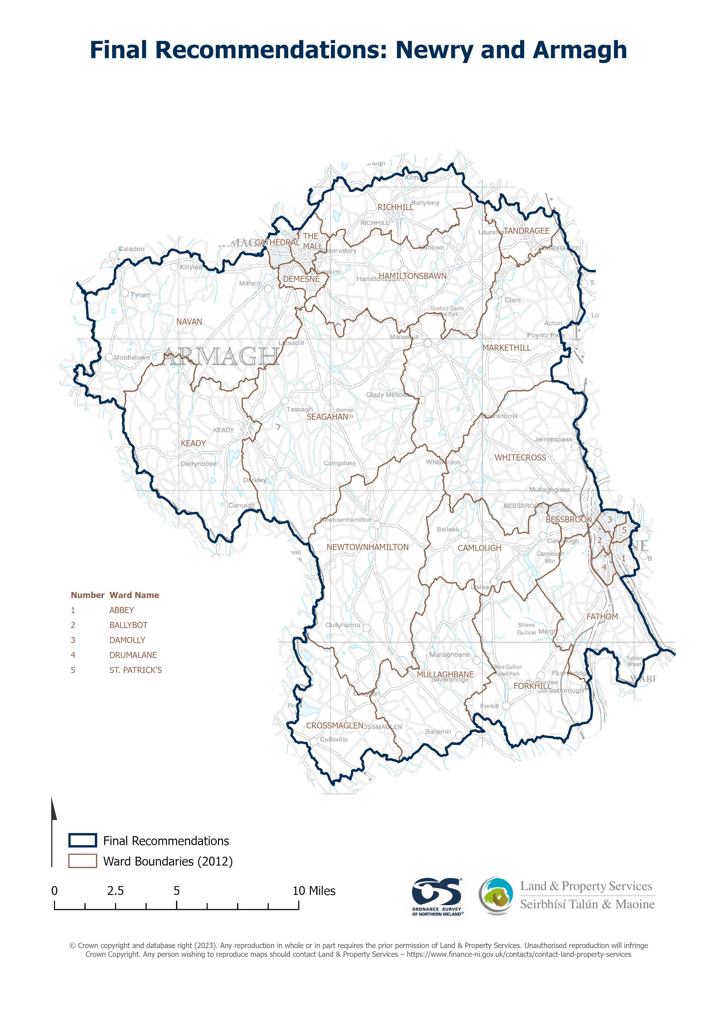
Raster download of Parliamentary Constituency 2023 of Newry and Armagh. The OSNI Large-scale Parliamentary Constituencies boundaries is a dataset consisting of official boundaries as...
Source: OSNI OpenData - Parliamentary Constituencies 2023 - Newry and Armagh
There are no views created for this resource yet.
Additional Information
| Field | Value |
|---|---|
| Data last updated | 25 August 2025 |
| Metadata last updated | 25 August 2025 |
| Created | 25 August 2025 |
| Format | JSON |
| Licence | UK Open Government Licence (OGL) |
| Access url | https://docs.spatialni.gov.uk/OpenData/OSNIOpenData_ParliamentaryConstituencies2023/PC2023_Newry_and_Armagh.png |
| Datastore active | False |
| Distribution ref | N2c0d5321a6ca41ddb465911360444b30 |
| Has views | False |
| Id | 326484f2-fe8a-45f7-bfc7-8fc2f8e2d803 |
| Mimetype | application/json |
| Package id | 110f65fb-a781-44bc-a2bf-758d9bb68b7c |
| Position | 1 |
| Requested | False |
| State | active |